The woodlands and forests of North West England, including Lancashire in the medieval period were a permanent and important part of the landscape, both physically and economically. As such their management would have been prime importance to both the ruling and the peasant classes, providing both raw materials and work.
The extent of medieval woodland in this area would have been formidable. Being a remnant of the old wildwood, in the early medieval period (1000 – 1100 AD), North West England was still heavily wooded broken only by trackways and settlement clearings. Large areas of woodlands were under the control of the king and his earls, to the exclusion of the local peasant population. The Doomsday Book lists the amount of land that was under woodland and who held it. For the area of Lancashire “inter Ripam et Mersham” (“between the Ribble and Mersey”) 1619 Miles 2 (419611 Hectares) were woodland (see appendix) compared with 1.2 Miles 2 (314 Hectares) in 1988.
The management and use of trees during this period produced different types of woodland depending on how the landscape was put to use. Michael Aston suggests that woodland management was a self-generating system, the supply of wood and timber were infinitely renewable and two types of crops were taken. The first crop was taken at intervals of 30 years; this was trees for timber production. Timber being defined as any trunk or branch of a tree that was greater than 5” in diameter i.e. thicker than a mans upper arm the second crop was of underwood and coppice cropped in seven year cycles. Underwood was the small, bushier younger growth found on the woodland floor and used especially for fencing, thatching wood and for wattle in wattle-and-daub walling. A system of rotation was adopted so that with different crops could be taken from different parts of the wood each year, and to guarantee a regular supply of these raw materials specific management techniques were used.
Coppicing known as Silva minutia in the Domesday Book is derived from the French word couper ‘to cut’. This technique required the tree to be cut down to ground level leaving a stool, the main trunk then regenerates by putting out a number of smaller trunks. Until the young growth were strong enough to withstand browsing by animals, the coppiced tree required protection, and earth banks topped with a fence of dead or live hedge surrounded the coppiced areas. In large woods, different sections of coppice were cropped at intervals over several years to provide usable wood for various uses depending on the variety of tree. Evidence for such activity is in place names such as Spring Wood on the Heskin Hall estate at Heskin, which may indicate an area of coppice woodland. The name is derived from the fact that once cut new growth would ‘spring’ up from the old stools. Typical trees species suitable for coppicing were ash, elm, hazel and maple.
Scattered throughout the coppiced woodland were standard trees, usually of oak that would be allowed to grow to their full height, over a period of between 30 to 70 years. These were used to produce the heavier constructional timber; and would only be felled in special circumstances.
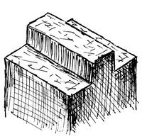
On the edges of the woodlands and in hedgerows pollarded trees would be found. Derived from the Dutch word Polled or N. Fr Poll to behead, these trees were clean cut at a height of between 2 to 5m and, just as in the case of coppicing the tree would regenerate and produce new growth, the only difference being that this was out of the reach of grazing animals. Typical trees species suitable for pollarding would be oak ash, hornbeam, willow and beech.
Producing a ‘lollipop’ shaped tree, shredding was the regular removal of lower lateral branches from the trunk of the tree this produced a thin trunk and a permanent leafy crown at the top. The branches were probably used for firewood and the trunks for long straight poles.
On the lowland areas of Lancashire and especially around Croston and Eccleston, oak would have been the most common tree to be found in woodlands, and in fact still is. It is a strong durable wood, which is pliable and workable years after felling, but when seasoned it was virtually impossible to saw and axe across the grain. A tree grown in the open could have a 25m canopy with several massive branches whilst a tree grown in a woodland environment would grow tall and straight with fewer branches. The smaller trees would be felled ‘as and when’ required. Evidence from medieval timber framed ‘Cruck’ building show that the carpenter would choose the smallest tree that would generate the required size of beam to minimise waste and effort. North West England has a high density of ‘cruck’ building; the curved uprights are formed from bent trees, which usually grow on steep exposed sites. The massive centre posts of Windmills required a specific size of wood and were made from a standard tree usually oak and could easily be 12m long, 600mm diameter and weighing 3-4 ton. Prestige construction projects could require unique timbers of such large dimensions that they would have to be sourced ten’s of miles away from the construction site. This was the case for the Lantern at Ely cathedral in 1328. These beams needed to be 19m long and a diameter of 800mm at the top. This type of sourcing must surely have taken place in the North West also.
Following the Norman victory at Hastings in 1066, the management of the countryside became more focussed on its profit making potential. Just like a present day multinational taking over a smaller company who are only interested in asset stripping, the new Normans rulers needed a comprehensive survey of what land was available, how it was used and who owned it. This was carried out in 1086 in the form of the Domesday Book. The Normans wanted to squeeze every penny they could out of the land and one way in which this could be achieved was to maximise the way that the land was managed.
As well as producing wood and timber from the woodlands, other types of ‘businesses’ were incorporated into them, one of the simplest being the introduction of ‘managed’ animals in the form of deer, boar and game bird within the new parks. Deer and wild boar would live, deep in the woods and to assist with their capture a clearing of woodland pasture known as launds (SiIva Pastoralis in the Domesday Book) would be formed. Food would be placed in these clearings and once the wild animals were used to this regular supply of food they would become semi-domesticated and easier to catch. Documentary evidence exists that shows that at in 1295 at Ightenhill an income of £3-6-1d was generated form the capture of 80 wild boar from the wooded park. In higher districts of Lancashire and particular in Yorkshire, areas that were once launds may be indicated in place names that contain the element thwaite, derived from the O.N. þveit a forest clearing such as Micklethwaite – the large clearing.
Woodland was also managed to allow various other ‘crops’ and activities to take place. At certain times of the year domestic animals would be let into the woodland to graze ‘at a price’. In the autumn, domestic pigs would be allowed to graze on the pannage, that is the acorns or beechnuts that fall from the trees, specialist management techniques would be required to ensure the availability of this crop. Cattle may have been brought in agisted and fed on the stubble once the hay had been cut and removed from the launds. In Toxteth Park in 1258, £0-4-3d was paid to allow cattle to feed on the fogg (hay stubble).
Tan Pit farm part of Gillibrand Hall estate in Chorley once stood adjacent to the Halls woodland; this may have been an early tanning site. The bark would have been stripped from coppiced thinnings and used in the tanning of hides, producing a dual income from one raw material.
A raw material that was highly valued during the mediaeval period was bees wax. One of it main uses would be for bees wax candles, used by the monastic communities. These candles produced a cleaner burn than the tallow candles used by peasant classes. Place names containing the element Biker may indicate areas of woodlands used by beekeepers such as Bickerstaffe in Lancashire.
Physical evidence for the management of mediaeval woodlands has all but disappeared in the 21st century. But, indicator species such as Dog’s Mercury (Mercurialis perennis), Lesser Celendine (Rannuncules ficaria), and drifts of Bluebellls (Hyacinthoides non-scripta), and Ramsons (Allium ursinum) found growing in an isolated copse may be the only evidence left to show that it was once part of a larger woodland environment. ‘Out of context’ place names now found in the middle of new housing estates may also hint of past uses. Colt House Close, part of the Langdale housing estate at Leyland is built on the site of Colt House Wood. Colt Wood may been a clearing in a section woodland of a park used to separate juvenile male horses from the rest of the herd.
The former BAE SYSTEM factory at Chorley (the ROF) was a 1000 acre site that has been closed to public access for over 50 years and contains the largest expanse of untouched woodland in the area. Worden wood takes its name from Worden Hall, the original seat of the Anderton / Farington family, which dates back to at latest 1509. This woodland still contains ditches and banks, and large pollarded trees once stood on its edge (these tree were cut down during the redevelopment of the site) The 1928 Ordnance Survey Map clearly shows rides and possible fish ponds still existed within the wood.
Following the Norman invasion in 1066, the governing of the country and in particular the countryside and woodland management passed over to the ‘accountants’. This fundamental shift in management required the maximisation of profit from the woodland environment.
As I have endeavoured to show, by looking at documentary evidence particularly from monastic sources, place name and physical evidence from Chorley and Leyland area, which evidence for this shift in woodland management in the medieval period can still be found.
The extent of medieval woodland in this area would have been formidable. Being a remnant of the old wildwood, in the early medieval period (1000 – 1100 AD), North West England was still heavily wooded broken only by trackways and settlement clearings. Large areas of woodlands were under the control of the king and his earls, to the exclusion of the local peasant population. The Doomsday Book lists the amount of land that was under woodland and who held it. For the area of Lancashire “inter Ripam et Mersham” (“between the Ribble and Mersey”) 1619 Miles 2 (419611 Hectares) were woodland (see appendix) compared with 1.2 Miles 2 (314 Hectares) in 1988.
The management and use of trees during this period produced different types of woodland depending on how the landscape was put to use. Michael Aston suggests that woodland management was a self-generating system, the supply of wood and timber were infinitely renewable and two types of crops were taken. The first crop was taken at intervals of 30 years; this was trees for timber production. Timber being defined as any trunk or branch of a tree that was greater than 5” in diameter i.e. thicker than a mans upper arm the second crop was of underwood and coppice cropped in seven year cycles. Underwood was the small, bushier younger growth found on the woodland floor and used especially for fencing, thatching wood and for wattle in wattle-and-daub walling. A system of rotation was adopted so that with different crops could be taken from different parts of the wood each year, and to guarantee a regular supply of these raw materials specific management techniques were used.
Coppicing known as Silva minutia in the Domesday Book is derived from the French word couper ‘to cut’. This technique required the tree to be cut down to ground level leaving a stool, the main trunk then regenerates by putting out a number of smaller trunks. Until the young growth were strong enough to withstand browsing by animals, the coppiced tree required protection, and earth banks topped with a fence of dead or live hedge surrounded the coppiced areas. In large woods, different sections of coppice were cropped at intervals over several years to provide usable wood for various uses depending on the variety of tree. Evidence for such activity is in place names such as Spring Wood on the Heskin Hall estate at Heskin, which may indicate an area of coppice woodland. The name is derived from the fact that once cut new growth would ‘spring’ up from the old stools. Typical trees species suitable for coppicing were ash, elm, hazel and maple.
Scattered throughout the coppiced woodland were standard trees, usually of oak that would be allowed to grow to their full height, over a period of between 30 to 70 years. These were used to produce the heavier constructional timber; and would only be felled in special circumstances.
On the edges of the woodlands and in hedgerows pollarded trees would be found. Derived from the Dutch word Polled or N. Fr Poll to behead, these trees were clean cut at a height of between 2 to 5m and, just as in the case of coppicing the tree would regenerate and produce new growth, the only difference being that this was out of the reach of grazing animals. Typical trees species suitable for pollarding would be oak ash, hornbeam, willow and beech.
Producing a ‘lollipop’ shaped tree, shredding was the regular removal of lower lateral branches from the trunk of the tree this produced a thin trunk and a permanent leafy crown at the top. The branches were probably used for firewood and the trunks for long straight poles.
On the lowland areas of Lancashire and especially around Croston and Eccleston, oak would have been the most common tree to be found in woodlands, and in fact still is. It is a strong durable wood, which is pliable and workable years after felling, but when seasoned it was virtually impossible to saw and axe across the grain. A tree grown in the open could have a 25m canopy with several massive branches whilst a tree grown in a woodland environment would grow tall and straight with fewer branches. The smaller trees would be felled ‘as and when’ required. Evidence from medieval timber framed ‘Cruck’ building show that the carpenter would choose the smallest tree that would generate the required size of beam to minimise waste and effort. North West England has a high density of ‘cruck’ building; the curved uprights are formed from bent trees, which usually grow on steep exposed sites. The massive centre posts of Windmills required a specific size of wood and were made from a standard tree usually oak and could easily be 12m long, 600mm diameter and weighing 3-4 ton. Prestige construction projects could require unique timbers of such large dimensions that they would have to be sourced ten’s of miles away from the construction site. This was the case for the Lantern at Ely cathedral in 1328. These beams needed to be 19m long and a diameter of 800mm at the top. This type of sourcing must surely have taken place in the North West also.
Following the Norman victory at Hastings in 1066, the management of the countryside became more focussed on its profit making potential. Just like a present day multinational taking over a smaller company who are only interested in asset stripping, the new Normans rulers needed a comprehensive survey of what land was available, how it was used and who owned it. This was carried out in 1086 in the form of the Domesday Book. The Normans wanted to squeeze every penny they could out of the land and one way in which this could be achieved was to maximise the way that the land was managed.
As well as producing wood and timber from the woodlands, other types of ‘businesses’ were incorporated into them, one of the simplest being the introduction of ‘managed’ animals in the form of deer, boar and game bird within the new parks. Deer and wild boar would live, deep in the woods and to assist with their capture a clearing of woodland pasture known as launds (SiIva Pastoralis in the Domesday Book) would be formed. Food would be placed in these clearings and once the wild animals were used to this regular supply of food they would become semi-domesticated and easier to catch. Documentary evidence exists that shows that at in 1295 at Ightenhill an income of £3-6-1d was generated form the capture of 80 wild boar from the wooded park. In higher districts of Lancashire and particular in Yorkshire, areas that were once launds may be indicated in place names that contain the element thwaite, derived from the O.N. þveit a forest clearing such as Micklethwaite – the large clearing.
Woodland was also managed to allow various other ‘crops’ and activities to take place. At certain times of the year domestic animals would be let into the woodland to graze ‘at a price’. In the autumn, domestic pigs would be allowed to graze on the pannage, that is the acorns or beechnuts that fall from the trees, specialist management techniques would be required to ensure the availability of this crop. Cattle may have been brought in agisted and fed on the stubble once the hay had been cut and removed from the launds. In Toxteth Park in 1258, £0-4-3d was paid to allow cattle to feed on the fogg (hay stubble).
Tan Pit farm part of Gillibrand Hall estate in Chorley once stood adjacent to the Halls woodland; this may have been an early tanning site. The bark would have been stripped from coppiced thinnings and used in the tanning of hides, producing a dual income from one raw material.
A raw material that was highly valued during the mediaeval period was bees wax. One of it main uses would be for bees wax candles, used by the monastic communities. These candles produced a cleaner burn than the tallow candles used by peasant classes. Place names containing the element Biker may indicate areas of woodlands used by beekeepers such as Bickerstaffe in Lancashire.
Physical evidence for the management of mediaeval woodlands has all but disappeared in the 21st century. But, indicator species such as Dog’s Mercury (Mercurialis perennis), Lesser Celendine (Rannuncules ficaria), and drifts of Bluebellls (Hyacinthoides non-scripta), and Ramsons (Allium ursinum) found growing in an isolated copse may be the only evidence left to show that it was once part of a larger woodland environment. ‘Out of context’ place names now found in the middle of new housing estates may also hint of past uses. Colt House Close, part of the Langdale housing estate at Leyland is built on the site of Colt House Wood. Colt Wood may been a clearing in a section woodland of a park used to separate juvenile male horses from the rest of the herd.
The former BAE SYSTEM factory at Chorley (the ROF) was a 1000 acre site that has been closed to public access for over 50 years and contains the largest expanse of untouched woodland in the area. Worden wood takes its name from Worden Hall, the original seat of the Anderton / Farington family, which dates back to at latest 1509. This woodland still contains ditches and banks, and large pollarded trees once stood on its edge (these tree were cut down during the redevelopment of the site) The 1928 Ordnance Survey Map clearly shows rides and possible fish ponds still existed within the wood.
Following the Norman invasion in 1066, the governing of the country and in particular the countryside and woodland management passed over to the ‘accountants’. This fundamental shift in management required the maximisation of profit from the woodland environment.
As I have endeavoured to show, by looking at documentary evidence particularly from monastic sources, place name and physical evidence from Chorley and Leyland area, which evidence for this shift in woodland management in the medieval period can still be found.